Kilcolman Jobson Map of the Munster Plantation, ca. 1590-92
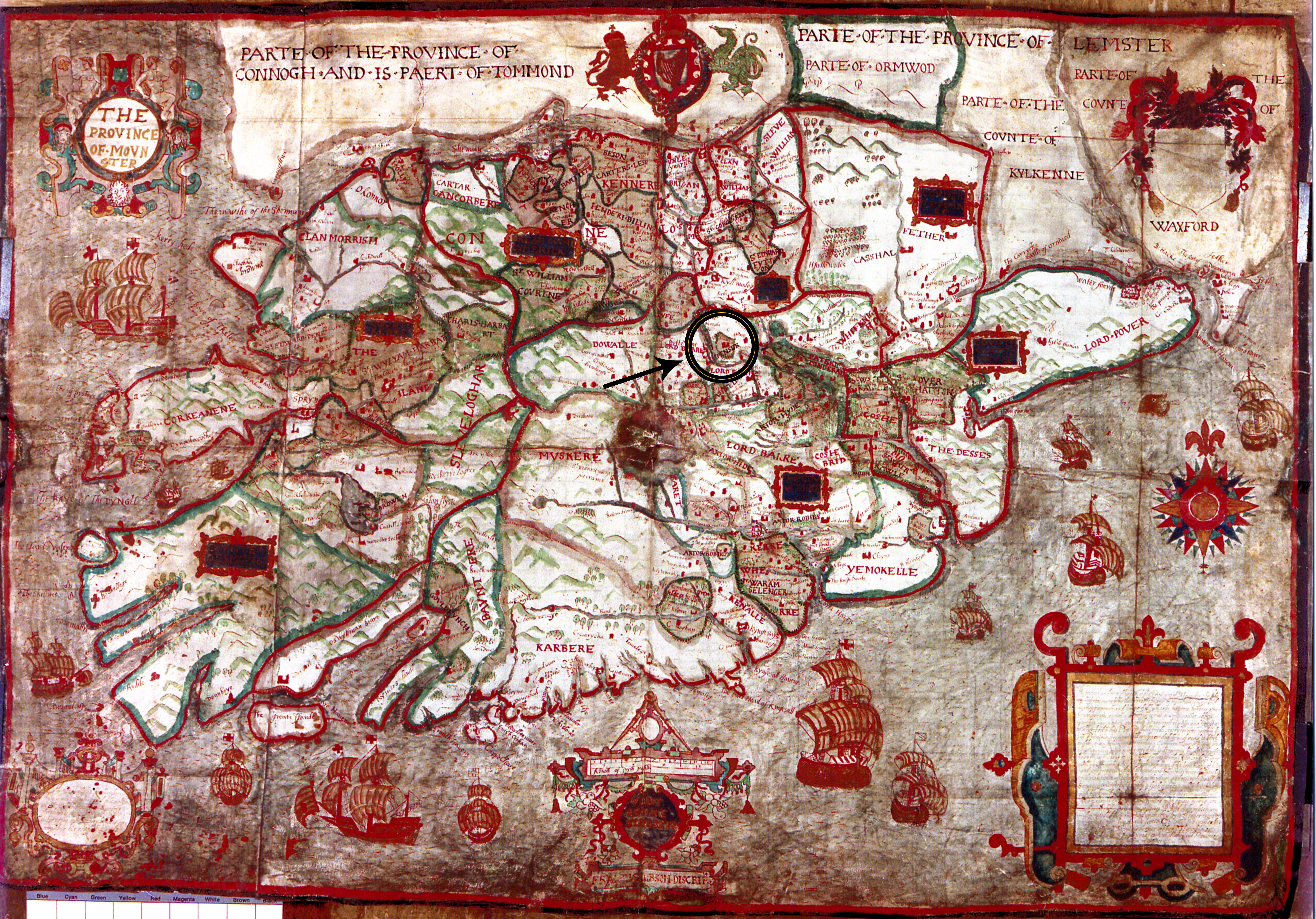
Map of “The Province of Mounster“ (ca. 1590-92) by Francis Jobson. Jobson outlines and fills in (mostly with brown) many of the areas held by New English planters, whose names are written in red or black alongside other place-names and names of lordships. North is at top. The name “Spenser,“ in the approximate area of Kilcolman, is written near and to the north-east of the center of the map. To the immediate west of Spenser’s name is written “Lord Barre“ (for Barry) and, to the south, “Lord Roche.“ Both were powerful Old English lords. The name “Sr Watr Rawle“ (for Sir Walter Raleigh) is written in two places due east of the center of the map, above and below the place-name “Coshe“ along the Blackwater River. The names of both planter-poets can be seen more clearly in the provided detail. Note the Irish coat of arms with harp and English and Welsh supporters (a lion and a dragon, respectively) at the top, and the many ships flying the English flag that surround the coastline. (NLI MS 16.B.13, reproduced courtesy of the National Library of Ireland.)